
The third day dawned foggy, visibility a quarter mile or less. Foghorns to north and south played a two-note duet every 10 seconds. I remembered the trip Mark and I did last year, fog-bound for 3 days. I didn't want to do that again. I'd planned to move camp to Barnes Island. It was a long open-water crossing to do through the fog, across the current at the mouth of Head Harbor. So I devised a longer route that would be easier to accomplish in the fog. I planned to travel back down along the islands I'd explored yesterday - since I'd be able to recognize them in the fog - to Indian Island, which was very close to Deer Island's shoreline. Then I'd wait for the tide to change (so as not to chance being swept toward the Old Sow), and let it carry me up the coast of Deer Island to St. Helena Island. From there I could island-hop to Barnes, never being very far from the sight of land, even in the fog (green route below).

It's beautiful paddling in fog. The air is almost always calm (wind would blow the fog away), the water surface serene even in this place where current never ceases. I have to admit that I felt some qualms paddling away from Casco, unable to see the next island, following just a compass bearing into thick white void. But before long I found it.

Harbor porpoises popped up to cheer me on my way, then disappeared leaving me with the usual empty photo.
It didn't take long to make it to Indian Island, and then I had time to wait before the tide changed (this was wise to do, given the noisy mad rush of the water here). Fortunately the beach was made of wonderful skipping stones, which occupied me for awhile. Then I tried playing mancala with myself - white stones vs. black stones - but couldn't remember the rules and was pretty sure white cheated to win.
I'd tied the kayak to this wonderfully-festooned tree, pulling it up higher every couple of minutes:

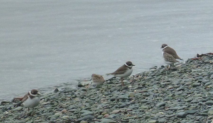
These little shore birds came by to forage in the high-tideline seaweed. I don't know what they are - perhaps someone can identify them for me. They were not afraid of me, and I felt certain they were passing harsh judgment on me for cheating at mancala. Whatever.
Finally the beach had all but disappeared, the noise of the water had dimmed, and the currents wandered confusedly this way and that. The tide was changing; it was time to cross to Deer Island, somewhere over there through the fog. Following a compass bearing, I was soon there.
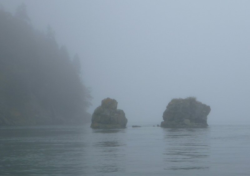
Paddling up the coastline as the fog thickened and rain spattered down, ghostly figures appeared and disappeared.
It was beautiful paddling, and I could keep track of my progress on the chart pretty easily. Eventually I reached St. Helena Island. it was time to leave the security of the Deer Island shore and head back out amongst the islands. I followed the edge of St. Helena, then glimpsed the next one, Beans Island, as a dim thickness in the fog. Crossing to Beans, I followed its shoreline around past the deep cove, then made the turn at the northern edge.
But wait. There was another island next to Beans, where there shouldn't be one! What the... Where was I on the chart? Had I mistaken my position? How would I sort this out?
Then I remembered - my GPS! I'd plugged in the waypoint coordinates for Barnes Island. I could navigate to it that way. I pulled out the GPS. Sure enough, Barnes showed up, due east. I looked eastward.
Blank fog.
What if I'd plugged in the coordinates wrong? I'd done that with one island on our last trip, but fortunately it hadn't mattered to us. But this time, if I was aimed wrong and missed the island, I'd be in the open outgoing current headed directly for Nova Scotia.
The GPS insisted, go EAST.
I started paddling, keeping an eye on the receding island behind me, feeling the current tugging on me seaward. Eventually I could not see land anywhere. The GPS told me EAST. And then, something slightly darker about the fog. Yes, an island! Simpsons! And just beyond it I found Barnes.

This was the first paddling where I felt ocean swell coming in. I was no longer in the shadow of Campobello. Rough waves broke on the outer cliffs of Barnes Island. I bounced through them, rounded a corner, and came to the wide beach above. Landing, I found a lovely campsite at the top of the beach. I unloaded the boat, set up camp, and set out to hike around the island.

Fall asters bloomed here, and foliage was beginning to turn its autumn colors. A weir lurked dimly offshore in the fog.

This was a lovely island, even in fog and rain.
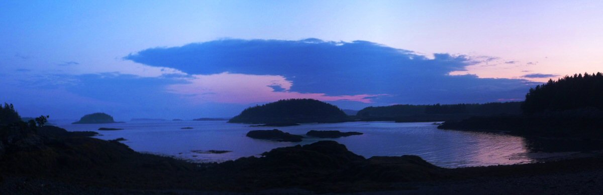
That evening after dinner, rain and wind began to increase. I added extra pegs to the tent fly and climbed in to await a storm. The wind picked up mightily, blew for about an hour... then stopped. It was almost dark when I unzipped the flap to have a look outside. There before me I was astonished to find a view that I had not suspected. The air had cleared, all the blank white fog blown away, and into the distance was island after island, painted with the colors of sunset. It was a magical moment at the end of a long day.
dinner = Trader Joe's Peanut Satay with dehydrated veggies
page 5